|
 |

Summary
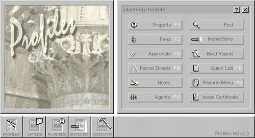
 The ProfilesTM
Planning module works with the Road Management
System (RMS). This system is described in the next item. All parcel projects
(neighborhoods, mobile home parks, etc.) are maintained in this system.
Street names and numbers are entered here and would automatically become
part of the primary street file system; the RMS records. If desired, parcel
projects can also be tracked through the approval process, track any fees
related to the process and so forth. As with the Licensing / Agent
Management Module, all agents involved with parcel projects, contractors,
surveyors, developers, engineers are logged in and tracked, thus providing
your office with a complete database of players in the industry. You may
also track projects with an inspection and note system, print parcel
approval certificates, reports, data sheets and mailing labels. The ProfilesTM
Planning module works with the Road Management
System (RMS). This system is described in the next item. All parcel projects
(neighborhoods, mobile home parks, etc.) are maintained in this system.
Street names and numbers are entered here and would automatically become
part of the primary street file system; the RMS records. If desired, parcel
projects can also be tracked through the approval process, track any fees
related to the process and so forth. As with the Licensing / Agent
Management Module, all agents involved with parcel projects, contractors,
surveyors, developers, engineers are logged in and tracked, thus providing
your office with a complete database of players in the industry. You may
also track projects with an inspection and note system, print parcel
approval certificates, reports, data sheets and mailing labels.
Top of Page
Read More
Features
Profiles Road Management System (RMS)
module first creates a road file system, then creates municipal addresses
from that road database system. The road file system technique can be
helpful when identifying all parish roads for locating, maintaining and
permitting. Either method chosen, the system would be accessible from the
Profiles Main Menu. The data files may link to ESRITM or
ArcViewTM GIS file type systems.
Top of Page
Read More
Advantages
User Editable Tables:
Create or modify your political districts
Create or modify your zoning districts
Create or modify personnel data
Create inspection fees
Create or modify different types of inspections
Create or modify planning fees
Create or modify various property agents
Track and promote property variances into new parcel developments
Top of Section
Top of Page
|